
Nothing says an Australian summer like spending a hot day by the waterside. Why not make the NSW South Coast your next destination for a bike riding adventure?

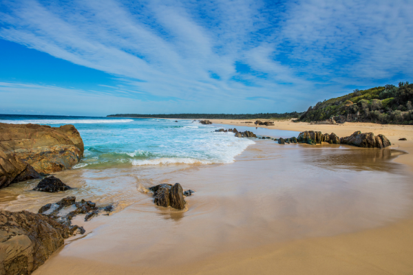
The Eurobodalla region is full of places to explore and things to do. There are stunning beaches, rivers and inlets with great places to swim, surf, snorkel, dive, kayak and fish. This also means some of the best fresh seafood available in NSW.
Montague Island is on the doorstep with a colony of fur seals and over 90 bird species to visit.
Between its history, culture and national parks, you’re sure to find your next adventure.
We recommend checking the NSW Health website for an update on the COVID-19 situation before travelling. As always, be sure to check the weather forecast and bushfires warnings before going for a ride.
Rides To Do
Tuross Head Foreshore
Distance: 10km
Total elevation: 117m
Elevation profile: Undulating – flat for the first 6km, then a few hills till for rest of route
Surface: Sealed
Traffic: Light – on shared pathways
Difficulty: Easy
The magnificent waterways of the popular coastal hamlet of Tuross Head are the setting for this easy and enjoyable family ride.
The ride follows the Coila Lake, ocean and Tuross River foreshores on the off-road shared pathway. There are stunning ocean views, rocky outcrops, the Norfolk Pines, dramatic headlands and bird-life for enthusiast photographers, as well as shops, picnic areas and toilets en-route.
You can start from anywhere on the pathway, but starting at the Coila Lake end will ensure you work up an appetite and thirst for coffee and food at the boat sheds area on Tuross Lake, near the end of the ride.
There is interpretative signage along the route, and a brief side trip into the Memorial Gardens at Plantation Point is worthwhile; a popular wedding spot with a picture perfect ocean backdrop. Further along the cycleway, detour by foot out to One Tree Point which provides an impressive view along the coast.
This easy route is predominantly a shared off-road cycleway and so minimal directions are needed. Start at the northern end of the cycleway at Kyla Oval, Hector McWilliam Drive and continue south along the cycleway to the beach car park at Tuross Boulevard.
Resume the ride travelling along the path until you connect with Clive Court then veer left into Nelson Parade. Continue until you arrive at the car park to the restaurants.
Moruya to South Head
Distance: 10km
Total elevation: 113m
Elevation profile: Flat
Surface: Sealed
Traffic: Medium – on main roads and shared pathways
Difficulty: Easy
Ride along the serene and stunning Moruya River down to the ocean and river mouth at South Head on this easy ride.
The light at certain times of the day along the river is incredibly beautiful, and the mountain wilderness backdrop is picture perfect.
Call in at Preddeys Wharf boat ramp to check out the catch of the day and enjoy the beautiful river estuary.
This ride starts at Riverside Park in Church Street near the Moruya Swimming pool. There are a number of places to park. The Moruya Markets make this area a hive of activity on Saturday mornings.
Before heading out to South Head you might want to do a short ride along the bank of the river upstream towards the Hospital. This is on a shared pathway. Just head upstream (west) from Riverside Park and pass under the bridge. The ride to South Head generally follows the Moruya River out to the ocean.
Once at the Surf Club you can extend the journey (1.5km return) up the hill to the river mouth headland where you can check out the Historic Cemetery. This is a great view point and a great spot for whale watching in the spring.
Nelligen towards Benandra loop
Distance: 25km
Total elevation: 386m
Elevation profile: Undulating
Surface: Sealed and unsealed
Difficulty: Moderate
The ride starts at the waterfront in Nelligen village.
The 25km scenic loop through the Benandarah State Forest, follows the ridge tops to the east of Nelligen utilising Old Nelligen Rd, Iron Bark Range Rd, Shannons Rd and Lookout Rd.
This ride is rated as moderate difficulty with undulating terrain and unsealed surface.
Bodalla To Reedy Creek Rd
Distance: 25km
Total elevation: 254m
Elevation profile: Undulating – flat for the first 10km, then a few hills for rest of route
Surface: Sealed and unsealed
Traffic: Medium – on main roads and dirt roads
Difficulty: Moderate
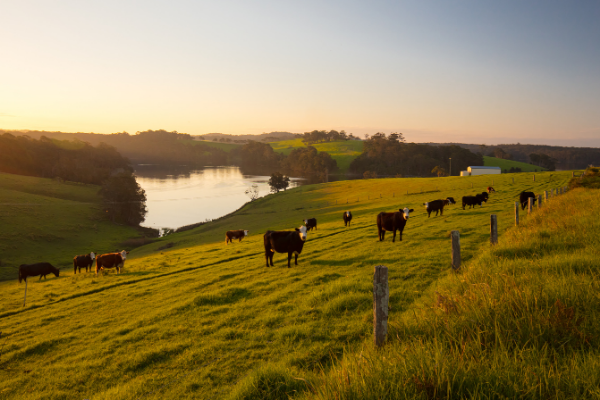
This is a very scenic ride that travels through the dairy and grazing land of the Tuross Valley, before turning off along the old road that follows Reedy Creek through the forest.
The first and last 10kms of this route are sealed, the remainder is gravel road of varying quality. The lesser used middle 15kms has the roughest surface. The ride follows Eurobodalla Rd along the Tuross River and then Reedy Creek Rd to Morts Folly Road and returns to Bodalla by the same route.
The turnaround point is at Reg Murphy Bridge which is a convenient spot for a picnic. The terrain is generally undulating with one hill up to Cobra Rd intersection at 15kms out of Bodalla.
Note: This is a one-way route. The return journey can be the same or up Cadgee Mtn Road to the Nerrigundah Mtn Rd back to Eurobodalla Rd.
Thanks to EuroBUG for their route suggestion.
Wagonga Inlet
Distance: 39km
Total elevation: 643m
Elevation profile: Hilly
Surface: Sealed and unsealed
Traffic: Medium – on main roads and dirt roads
Difficulty: Hard
Ride through beautiful forest, alongside coastal wetlands and along an amazing stretch of coastline. This forest and ocean cycle loop west of Narooma is a true pleasure.
The ride starts at the car park on Riverside Drive, Narooma, near the restaurants. It follows The Scenic Drive along the southern side of Wagonga Inlet right up to the top of the inlet where there is a good rest stop at the wharf. From there, it heads north into the forest along overgrown sections of road before joining Mitchells Ridge Rd and back to the Princes Highway.
Two kilometres of riding on the shoulder of the highway is then required to get to the Dalmeny turnoff. Care is required when crossing the narrow Lawlers Creek Bridge on the highway. The wonderful coastal shared pathway at the Dalmeny Sports Club and follow it all the way back to Narooma.
Look out for the viewing platform and story board adjacent to the wetland that captures the history and flora and fauna of the area as you’re heading into Narooma. There are café and restaurant opportunities in Dalmeny and Kianga, as well as Narooma, at the end of the ride.

Narooma to Tilba
Distance: 41km
Total elevation: 731m
Elevation profile: Hilly
Surface: Sealed and unsealed
Traffic: Medium – on main roads and dirt roads
Difficulty: Hard
Imagine the old carriages traversing the rugged roads and the old cycles creaking along with a basket out front filled with picnic goodies. Time really has stood still in the Tilba region.
The route is a mixture of sealed surface, gravel road, and gravel track (short sections). It has a number of short hills which gives it its moderate grading. The steepest section is when you make your way through the urban area of south Narooma. So don’t be put off!
This ride follows the Old Highway to the turn off to Central Tilba along Ridge Rd,. which leads to Tilba Punkalla Rd which takes you right into Central Tilba.
There are a number of other ways to get to Central Tilba from Narooma, this is the easiest route. The road is sealed for part of this route.
Central Tilba is a Heritage listed village full of wonderful crafts and food experiences. There are a number of cafes and a great cheese outlet. You might like to cycle on to Tilba.
Thanks to EuroBUG for their route suggestion.
Moruya to Araluen
Distance: 59km
Total elevation: 1380m
Elevation profile: Hilly
Surface: Sealed and unsealed
Traffic: Medium – on main roads and dirt roads
Difficulty: Hard
This ride follows the glorious Moruya River and the Araluen Creek all the way to the village of Araluen. Set in a picturesque and tranquil valley Araluen has a rich gold mining history and is today known for its lovely orchards and fruit. This is a beautiful ride with great riverside and mountain scenery.
This route is undulating and has mainly a gravel surface after the first 7.5km, but is generally in reasonable condition.
This ride follows the Moruya / Deua River and then the Araluen Creek all the way to the village of Araluen. It is in the spectacular Deua National Park for much of its length.
Special care should be taken on the blind corners where the road is narrow and oncoming vehicles may encroach on your side of the road. The Araluen Hotel can be a turnaround for a long ride back or can be a great place to stay overnight before returning the next day.
Note: This is a one way route, but you can ride the same way back as you came.
Batehaven to Moruya
Distance: 71km
Total elevation: 900m
Elevation profile: Undulating – flat section in middle of the ride (20km to 50km), rest undulating
Surface: Sealed
Traffic: Heavy – on main roads
Difficulty: Hard
Take a tourist map with you as this will enable you to experience the many extra views just a short distance off this cycle route all the way down the coast. You can of course join this route at any point along it or do it in reverse.
There are a number of opportunities to explore coastal villages with magnificent rocky and sandy bays. At around 13km into the ride South Rosedale and at 15km Guerilla Bay are two examples.
As you flash past Tomakin (after 17km) consider a diversion out to Melville Headland for a great view of the coastline. When you come to the turn off to Mossy Point (19km) take the turn off and follow the road through to Broulee past more ocean views. If you seek coffee and a light meal try The Mossy Cafe at the eastern end of Pacific Street. You pass Pacific St 600m after turning off into Mossy Point. There is another great viewing point at the Tomaga River mouth headland in Mossy Point.
In Broulee you can deviate by turning left down Heath Street to the Surf Club and the main surf beach, for more sweeping views south to Moruya Heads. Retrace your path back to Grant Street and turn left to head south again.
Rejoin George Bass Drive and keep heading south. At the southern end of the airport you have a chance to view the entrance of the Moruya River to the ocean. Take the turn off to the airport. At the start of the camping ground bear right and take the sealed road to the parking area. This is the start of the breakwater at the river entrance. Then retrace your path back onto the George Bass Drive, turn left and follow North Head Drive into Moruya. There are some short sections on this leg that have very limited shoulders and sharp bends so take care.
Places To See
This whole area is filled with fun activities to do in the water from swimming at the beaches, to snorkeling, kayaking or fishing. So head out and enjoy what the South Coast has to offer.
Narooma Lighthouse (Narooma)
Some important pieces of Australian history rest inside the Narooma Lighthouse Museum, located at the Narooma Visitor Centre.
The original light and optical apparatus from the Montague Island Light Station - the last in NSW to be manned, and is still the only remaining occupied light station on the NSW coast – are stationed here.
From the lighthouse you’ll also get stunning views of the coast. Depending on the time of year you visit, keep an eye out for whales.
Glasshouse Rocks and Pillow Lava (Narooma)
At either end of Surf beach sits an ancient site of geological importance. At the southern end, sits one of Australian most photographed rock formations - Glasshouse Rocks. The Geological Society of Australia dates them between 510 and 440 million years old.
While on the northern side sits the Australia Rock. It’s a rock formation with a hole, that resembles the shape of Australia. It’s a natural phenomena from volcanic activity over a hundred million years ago. It’s another much loved photography location.

Mogo Wildlife Park
Located 10km south of Batemans Bay, Mogo Wildlife Park is one of the most successful private zoos in Australia.
Over 250 animals live at the zoo including 44 rare & exotic species including gibbons, monkeys, cheetahs, otters, lions, pandas, tigers, tamarins, meerkats and many more.
