“Everybody needs beauty as well as bread, places to play in and pray in, where Nature may heal and cheer and give strength to body and soul alike.”
These are the wise words of environmentalist and philosopher John Muir who campaigned to establish Yosemite National Park in the 1890s.
More than a century later, over 50% of the world’s population lives in cities. It is well recognised that access to high-quality urban green space is essential for physical, mental, social and spiritual health.
Sydney’s emerging Green Grid
Sydney has many green and water-enriched spaces. However, they are not well-connected, limiting their contribution to our quality of life, the environment and the economy. So good access to urban green space is just as important as the green spaces themselves.
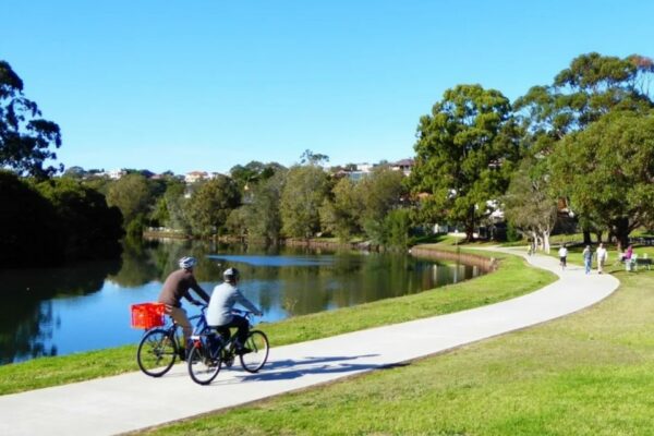
A picturesque stretch of the Cooks River in inner Sydney. A fabulous green-blue open space but it can be hard to reach from many nearby suburbs (Image: BikeTrail.blog)
“If the only way to get to a green space is by car, the value to the broader community can be severely compromised."
"Green spaces need to be easily accessible on foot, by bike, or using affordable public transport,” says Nick Chapman, an urban open space advocate, place manager and resilience specialist based in Sydney. “This can be achieved by urban greenways. A greenway connects a series of green public spaces with a network of well-designed walking and cycle paths, local ‘green streets’ or public transport routes. In Sydney, this emerging network is called the Green Grid.”
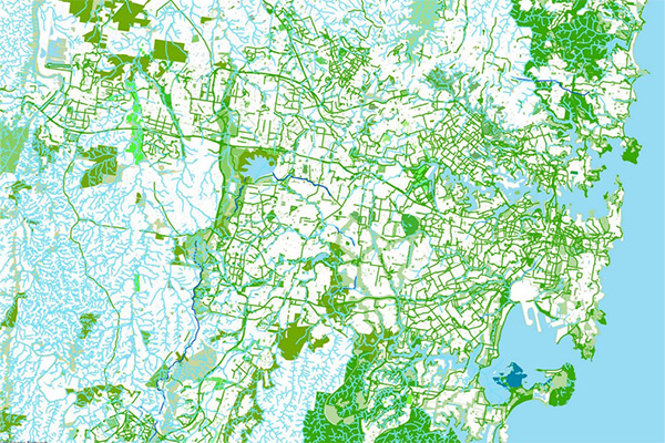
In 2017, a team led by Government Architect NSW identified a network of high-quality green spaces. A long list of project opportunities was drawn up to fill missing links. The aim is to create Green Grid that connects green space to town centres, residential areas, education and employment facilities and public transport hubs. Check out the Green Grid proposals for your area here. (Source: GANSW/Tyrrell Studio)
The Inner West GreenWay is a key Green Grid priority project
The GreenWay is a 6km environmental and active travel corridor linking the Cooks River at Earlwood with the Parramatta River at Iron Cove. It mostly follows the route of the Inner West Light Rail and Hawthorne Canal. It features bike paths and foreshore walks, cultural and historical sites, cafes, bushcare sites and a range of parks, playgrounds and sporting facilities.
The Greater Sydney Commission identified the GreenWay as the number one priority Green Grid project in the 2018 Eastern Sydney District Plan.
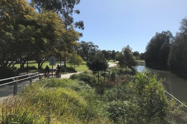
The Marion Street to Parramatta Road section of the GreenWay was upgraded in 2016 (Image: Nick Chapman)
Moreover, the GreenWay will play a very important role in Sydney’s active transport network. There are intersections with the Cooks River cycleway, the planned Sydney Metro East-West Pedestrian and Cycling Link (EWPLC), as well as the Bay Run. And a future separated bicycle path on Parramatta Road - we are ever hopeful!
The GreenWay is developing piece by piece
The northern section alongside the Hawthorne Canal is largely complete. However, the southern section from Parramatta Road to the Cooks River is criss-crossed by major roads and rail lines. Consequently, it has been much harder to plan and fund.
The completed shared path through Richard Murden Reserve is a delight! (Image: Nick Chapman)
“Greenway projects are often initiated by community volunteers. This can generate high levels of community participation and ownership of outcomes,” says Nick Chapman. “However, it is very difficult to implement a multi-purpose green corridor in a contested, car-dominated urban environment subject to increasing land values. Of course, a major challenge for the community is to garner adequate government support and funding. This can take years to achieve.” Nick was GreenWay Place Manager at the Inner West Council for 7 years.
After over 20 years of lobbying and community action, sufficient funds have finally been secured to complete the GreenWay at an estimated cost of $53 million. Most of the funding has been provided by the NSW Government, with contributions of around $9 million from Inner West Council and its predecessors.
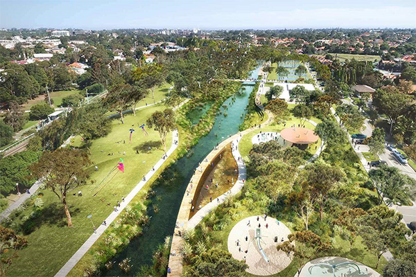
The future design concept for the northern section of the GreenWay, looking south from Haberfield. A high-quality shared path is now in place adjacent to the Hawthorne Canal. Further upgrades to the parklands on either side of the canal can be implemented as funding becomes available (Image: Inner West Council / McGregor Coxall from the 2018 GreenWay Masterplan)
The Missing Links are now under construction!
Concept and detailed designs for the GreenWay Missing Links were exhibited last year. Staged construction is now commencing. Read the Bicycle NSW submission here. The works include four high-quality tunnels under busy roads, construction of new shared pathways (mostly within the Inner West Light Rail Corridor), several major public art works and extensive landscaping. The missing links from Parramatta Road south to the Cooks River are expected to be completed by 2025.
This is such an exciting project for the Inner West community. It is clear that local and state politicians are very committed to the GreenWay. They recognise the outstanding benefits for the community and the environment.
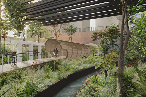
A snapshot of the journey along the GreenWay through Cadigal Reserve to Lewisham West and Dulwich Hill. Pedestrians and bike riders will enjoy the corridor’s rich rail, road and waterways heritage, new landscaped areas, a unique mural celebrating the area’s Aboriginal heritage and restored natural areas in the heart of the Inner West. This tunnel under Longport Street, Lewisham is one of four fantastic grade-separated tunnels forming part of the Missing Links project. (Image: Inner West Council / ASPECT Studios)
A greenway for Sydney’s north?
Greenways are being planned to connect up the Green Grid in other parts of Metropolitan Sydney. On the Lower North Shore, Willoughby City Council is championing another greenway project linking Middle Harbour with Artarmon. The route incorporates some existing paths along Flat Rock Gully and sections of the Gore Hill cycleway.
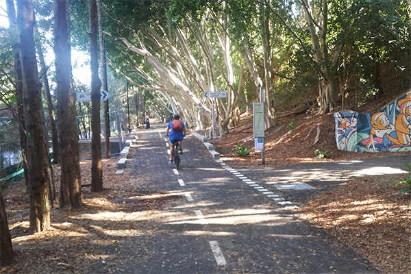
Tranquil and shady paths deep within Flat Rock Gully. These could be upgraded to create a walking and cycling link between Middle Harbour and Artarmon. (Source: Life Out and About)
The Artarmon to Middle Harbour GreenWay is a key action in Willoughby’s ground-breaking Resilience Strategy and Action Plan.
The plan identifies the shocks most likely to impact the people of Willoughby, such as extreme heat and flooding associated with climate change. Moreover, it responds to underlying stresses such as expensive housing, social isolation, transport congestion and loss of urban tree canopy.
The proposed greenway is one of several actions to help build community resilience. It will do this by enhancing community connections, supporting a healthy active lifestyle, alleviating transport stress and improving biodiversity and urban environmental quality. Nick is a key advocate for this new greenway in his current capacity as the Resilience Specialist at Willoughby City Council.
“Greenways help revitalise places through active travel. We have some very hot years ahead. Connected blue and green spaces will be critical to help cool the city and provide shady areas for leisure and recreation,” says Bicycle NSW Head of Advocacy, Francis O’Neill.
Help us advocate for more green infrastructure in NSW
If you are not already a Bicycle NSW Member, we would love you to consider joining us. Support our advocacy campaigns and ride with peace of mind knowing that you are covered by our comprehensive insurance.

